+966 56 615 6455
info@earthexplorer-ksa.com
Social media:

Archaeogeophysical

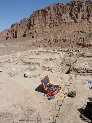
The near-surface geophysical methods of Investigation, archaeologists quickly mapping large areas, destructive excavation of archaeological properties outside the range of human perception and to avoid them or to minimize the physical dimensions are now widely used in archaeology to provide a means to detect. Enerson provides geophysical surveying services in archaeological research with GIS-based programs and software, the latest high-tech Geophysical devices.

Typical Geophysical Methods Applied

  • Ground radar (GPR)
  • Magnetic
  • ERT (Electrical Resistivity Tomography)
  • Electromagnetic
Arkeolojik alan manyetik anomali haritası
Arkeojeofizik ERT(Elektrik Rezistivite Tomografi) çalışması
Cart

Sepetinizde ürün bulunmuyor.

Select the fields to be shown. Others will be hidden. Drag and drop to rearrange the order.
  • Image
  • SKU
  • Rating
  • Price
  • Stock
  • Availability
  • Add to cart
  • Description
  • Content
  • Weight
  • Dimensions
  • Additional information
Click outside to hide the comparison bar
Compare