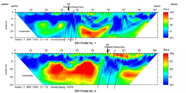
Several geophysical methods can be used for optimizing well water quality and efficiency. In this regard, we have extensive experience using these methods to help characterize aquifers, preparing hydrological map for the site, assess groundwater quality, and install wells and optimizing their design.
Enerson provides its customers with detailed technical and professional information about the source of aquifer locations, quality, and availability with effective and efficient geophysical applications. With the help of hydro-geophysical assessment before the drilling works, we determine easily the location of high-altitude aquifer areas with an accuracy of up to 90%.

Groundwater Applications
- Lithology mapping and geological characterization
- Aquifer characterization
- Water table depth
- Bedrock topography
- Fractures, fault and karst mapping
- Groundwater quality mapping
- Introduction to salt water and brackish water mapping
- 2D and 3D imaging
- Aquifer points
- Regional watershed survey
- Determination of bedrock boundaries
- Determination of karst regions
Applied Geophysical Methods
- Seismic reflection and refraction (2D and 3D))
- Electrical Methods
- Electromagnetic
- Magnetics
- Gravity
- Vertical E

